WEDNESDAY, 26 JANUARY 2011
Mention earthquakes and most people will think of places such as Japan and California, where major damaging earthquakes happen once every ten to twenty years. However, earthquakes can happen anywhere, including in the United Kingdom. Recently, there have been two small earthquakes in northern England: a magnitude 3.6 earthquake occurred in Cumbria on 21st Dec, 2010 [1], and a 3.6 magnitude earthquake was recorded in Yorkshire on 3rd Jan, 2011 [2].Most reports on these events are of rattling windows or shaking floors that passed within a few seconds. Low magnitude events such as these are unlikely to cause any damage, even if they are felt; damage is only likely to occur for earthquakes that are above around magnitude 5.5.
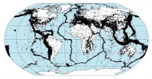
So what is an earthquake and what causes them? An earthquake is a sudden release of energy at the surface of the Earth that causes vibrations in the crust known as seismic waves. The most common places for earthquakes are near plate boundaries; the Earth’s surface is made up of huge sheets of rock known as tectonic plates. At the boundaries between these plates, the surface layers are constantly being pushed together, pulled apart, or slipping past each other. The release of energy in these events can be huge, leading to considerable damage. Fortunately, the UK is far from these plate boundaries, so is unlikely to experience a serious earthquake. However, you may wonder, why should the UK have earthquakes at all?
While earthquakes in general occur at plate boundaries, the stresses generated there can also be transmitted into regions inside the plate, causing intraplate earthquakes. In the UK, most earthquakes happen around an ancient rock formation known as the Midlands Microcraton. This feature runs through Birmingham towards the Potteries, and is made up of rocks that are harder than those around it. As a result, stresses at the Atlantic plate boundary, where the surface is being pulled apart, are concentrated onto the rocks on either side of the formation. This results in low magnitude earthquakes. In addition, there are also active faults at this formation, and rock movement at these faults also causes tremors on the western parts of the UK. Another source of earthquakes in the UK is the North Sea floor. The Earth’s surface is much thinner here and is more prone to moving under stresses.
On average, the UK experiences up to 300 earthquakes a year. Most of them are too small to be felt, but one that is around magnitude 3.5 or above (and therefore noticeable) still happens once every year on average. A magnitude 5 quake will happen every hundred years or so; the most serious earthquake experienced in the UK on record is a magnitude 6, which happened on the east side of the country in 1931.
To compare the sizes of earthquakes, geologists use the Richter scale and the moment magnitude scale. Both measure the amplitude of the vibration on a logarithmic scale, so for example a magnitude 5 quake will be ten times as strong as a magnitude 4 one. These two scales yield similar values, so news reports of earthquakes seldom mention which scale was used. However, the moment magnitude scale, which is a newer version, offers certain advantages over the Richter scale, such as giving a more accurate value for higher magnitude earthquakes.
Although the quakes felt in the UK are much smaller than the devastating ones that have struck places like Tokyo and San Francisco, it is still important to study earthquakes in the UK and tremors need to be taken into consideration when building certain structures. For example, engineers need to know how a nuclear power plant will respond to small scale shakings. Also, in places like London, the composition of the soil can magnify shakes, leading to more serious damage. In addition, any extra understanding scientists can gain of earthquakes can also help to reduce damage in other places where more serious and frequent earthquakes occur.
Written by Wendy Mak
Ed:The quakes reported here were subsequently followed by a third on 23rd January 2011. Recerded as magnitude 3.5 and centering on Glenuig in the Western Scottish Highlands [3].


